
Past Projects
Below are summaries of several recently completed CISA projects. You can find more information about other prior efforts including research findings, completed project reports, presentations, and posters in the CISA Library.
This project, funded by NOAA Climate Program Office’s Coastal and Ocean Climate Applications (COCA) Program, will use a four-step process to determine health-related impacts that result from environmental conditions. Focusing specifically on water and wastewater infrastructure, researchers will assess vulnerability to extreme events and rising sea levels and identify the populations most susceptible to public health risks from infrastructure failure. Using extensive stakeholder engagement in Charleston, SC, and Morehead City, NC, they will develop a susceptibility index of vulnerable populations to assess health threats. This will be a straightforward, user-friendly tool that succinctly summarizes the threats for decision makers of varying backgrounds and can assess susceptibility through a range of weather and climate events. The overall goal of the project is to expand capacity of a variety of decision makers (including public health officials, environmental agencies, emergency managers, water/wastewater operators) around the issues of critical coastal water infrastructure and public health.
CISA Collaborators
Tom Allen
Susan Lovelace
Burrell Montz
Jess Whitehead
Project Partner
- East Carolina University
- NC Sea Grant
- SC Sea Grant Consortium
Focus Area
Climate & Health; Coastal Climate
This study evaluated how well downscaled regional climate models simulate historical temperature and precipitation records for the Southeast US and identified factors that lead to differences in output between different downscaled models. Researchers also compared the outputs of these downscaled models to output from global climate models to determine if downscaling does, in fact, produce better information at a more decision-relevant scale.
CISA Collaborators
Greg Carbone
Erik Kabela
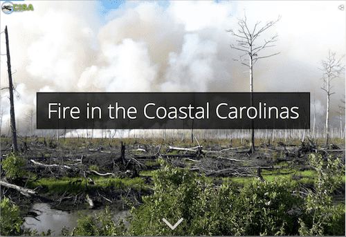
In 2017-2019, CISA and the National Integrated Drought Information System (NIDIS) provided support to the State Climate Office of North Carolina (SCONC) to expand the Coastal Carolinas DEWS Coastal Zone Fire Risk Assessment project conducted in 2014-2015. The purpose of this project is to provide organic soil moisture data and information to aid coastal zone fire risk monitoring and management. Traditional measures of drought and fire risk do not fully capture the organic soil conditions which can vary widely in terms of their terrain, root zone depth, and water table height. Local changes make monitoring conditions such as fire and smoldering risk a challenge, and few real-time monitoring stations have historically been present in remote areas. In 2018-2019 the SCONC deployed four organic soil moisture monitoring stations at locations in eastern North Carolina. Current and archived data from these stations are accessible on the SCONC’s Fire Weather Intelligence Portal where they provide real-time information for drought monitoring and fire risk decision making for the NC Forest Service, NC State Parks, and The Nature Conservancy. Learn more in this project overview.
Project Partner
- State Climate Office of North Carolina
Focus Area
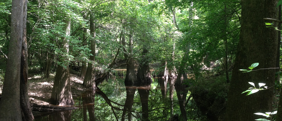
Coastal Climate; Water Resources
CISA researchers have contributed to a project to assess the potential effects of increasing temperatures (leading to increased evapotranspiration) and changing precipitation patterns on the ecosystems of Congaree National Park. Changing upstream flow patterns have the potential to affect these flood-dependent ecosystems through alterations in the timing, extent, and level of flooding. CISA team members developed watershed models to simulate streamflow under different climate change scenarios. This information served as inputs to a flood inundation model which is being used to assess the effects of altered flooding regimes on the quality and extent of habitats for key species in the park.
CISA Collaborators
Greg Carbone
Peng Gao
John Kupfer
Aashka Patel
Dan Tufford
Project Partners
- USC Department of Geography
- DOI National Park Service
Focus Area
Water Resources
This project addressed the potential vulnerability of municipal water and wastewater infrastructure to coastal hazards. Study sites were located in the North Carolina communities of Manteo, New Bern, and Plymouth. The team produced a series of detailed maps that include infrastructure location as well as the potential sea level rise, storm surge, and riverine flooding risks to those sites for the three communities. Risks to water lines and pump stations were included in the analysis based on advice from community planners. Participating communities were recipients of an aggregated benefit because this project allows multiple jurisdictions to be seamlessly assessed and a range of vulnerabilities visualized and compared; a benefit which would not be realized through individual community assessments.
CISA Collaborators
Tom Allen
Burrell Montz
Project Partner
- East Carolina University
Focus Area
Coastal Climate; Water Resources
CISA’s downscaling work seeks to answer stakeholder questions about future climate projections for the region. In several cases, this downscaled climate information has been incorporated into watershed-scale hydrologic models. Integrating climate information into watershed models improves understanding of the intricate relationship between the two. These watershed models have been used to assess the impact of saltwater intrusion under future climate and sea level rise scenarios and to estimate the potential for increased Vibrio occurrence due to projected climate changes.
In other instances, climate projects have been developed to answer questions about specific variables such as future temperature or rainfall patterns. This includes contributions to the South Carolina Coastal Counties Low Impact Design (LID) manual and the Climate Change Vulnerability Assessment Tool for Coastal Habitats.
CISA developed the Dynamic Drought Index Tool (DDIT) to meet regional needs for increased spatial resolution of drought maps and access to information about historical climate variability. The DDIT is a web-based monitoring and mapping tool that allows users to calculate and display drought indices at the spatial and temporal scales most relevant to their decision making. The tools consists of: a numerical model that calculates percentiles for each drought index and performs spatial interpolation and averaging; a database that stores the results from the numerical model; and a graphical user interface that provides user options for selecting drought indices, blending percentages, classification methods, and resultant maps, graphs, and tables. As part of this project, additional research was conducted to address various shortcomings regarding drought index estimation, such as missing daily precipitation data, handling short-term records, and obtaining drought information for unsampled locations.
CISA Collaborators
Greg Carbone
Kirstin Dow
Jinyoung Rhee
Project Partners
- Northeast Regional Climate Center
- South Carolina State Climate Office
- State Climate Office of North Carolina
Focus Area
Water Resources
There is considerable interest in forecasting future river-discharge levels and their downstream effects on blue crabs, one of the most important commercial fisheries in the Southeast but adversely affected by recent droughts. Low levels of freshwater discharge into the estuary changes the salinity profile which influences crab growth, movement, and survival. This project aims to identify and examine a range of possible changes in Edisto River discharge between now and 2030. Streamflow projections will be used as input for an individual-based blue crab model, developed by Michael Childress (Clemson University), to forecast future SC blue crab landings.
CISA Collaborators
Greg Carbone
Dan Tufford
Junyu Lu
Michael Childress
Project Partner
- Clemson University
Focus Area
Water Resources; Coastal Climate
This research project showed connections between growing season droughts and reductions in crop yields. The research aimed to “detrend” the time series to account for technological changes that have improved crop yields through time. Maps displaying NC and SC county-level yield anomalies for corn (1925-2016), soybean (1972-2016), and hay (1950-2008) are available in the Carolinas Precipitation Patterns & Probabilities Atlas.
CISA Collaborators
Greg Carbone
Junyu Lu
Focus Area
Water Resources
CISA conducted an array of studies in support of the Third National Climate Assessment, released in May 2014. Our efforts focused on identifying key climate sensitive decisions, improving our understanding of related climate information needs, and assessing the multiple dimensions of adaptive capacity in the region.
• Collaboration with key climate service providers.
Southeast RISAs (CISA, SECC), the Southeast Regional Climate Center, and state climatologists throughout the region partnered to document and evaluate climate information requests to better understand who submitted requests for what types of information. The broad range of engaged clients and the detail of their information needs is suggestive of larger, more diverse groups of advanced climate information users than are typically acknowledged by the climate adaptation community.
• Engaging climate-sensitive sectors in the Carolinas.
This research centered on understanding climate information needs, climate adaptation activities, and the networks that facilitate information sharing in five key sectors in the Carolinas – forestry, recreation and tourism, urban sustainability initiatives, wildlife and habitat conservation planning, and water-wastewater systems . Through document analysis and coupled questionnaire-interviews with key decision makers and opinion leaders, researchers documented significant information regarding existing capacity to respond and adaptive to climate change in the Carolinas.
• Climate adaptation in the Southeast.
In collaboration with the two other Southeast RISAs (SCIPP, SECC), CISA helped to produce a technical report for use in developing the Southeast regional chapter for the third NCA. CISA PIs led efforts on the climate chapter, developing the regional climatology and information on observed trends, and the adaptation chapter, assessing the complexity of climate adaptation efforts in the region.
CISA Collaborators
Kirstin Dow
Kirsten Lackstrom
Amanda Farris
Benjamin Haywood
Nate Kettle
The NIDIS Regional Drought Early Warning System (DEWS) programs are collaborative federal, state, and local interagency efforts to improve early warning capacity and resilience to drought. CISA contributed to the Coastal Carolinas DEWS through several efforts:
- The Citizen Science Condition Monitoring project enhanced the process of drought impacts monitoring and reporting. Tools and information developed through a Carolinas pilot program are now available as a national resource through the Community Collaborative Rain, Hail, & Snow (CoCoRaHS) network.
- The Carolinas Precipitation Patterns & Probabilities Atlas provides Carolinas-focused information about extremes (drought, heavy rainfall) and normal precipitation patterns.
- The Coastal Salinity Index was developed as a tool to characterize coastal drought and monitoring changing salinities in coastal surface-water bodies.
- CISA supported the establishment of an organic soil moisture monitoring network in eastern North Carolina.
- CISA co-organized several stakeholder events since the Coastal Carolinas DEWS was initiated, including the 2012 scoping workshop and 2016 planning meeting.
CISA Collaborators
Greg Carbone
Kirstin Dow
Amanda Farris
Kirsten Lackstrom
Project Partners
- State Climate Office of North Carolina
- USGS South Atlantic Water Science Center
Focus Area
Coastal Climate; Water Resources
CISA partnered with the Beaufort County Planning Department, the SC Sea Grant Consortium, NC Sea Grant, and the Social and Environmental Research Institute to provide a collaborative opportunity for local stakeholders in Beaufort County to learn from each other about the potential impacts of sea level rise and identify local strategies and actions to directly or indirectly reduce their vulnerability to these impacts. Using VCAPS, the project team recruited and facilitated discussion among a group of 19 local decision makers, who identified and prioritized an initial list of adaptation actions. The team then hosted two public workshops, attended by 77 people, to vet and contribute to this action list, narrowing it to 23 adaptation strategies. The final report was tailored to the needs of County officials and details local vulnerability to rising seas, the community input process, and the adaptation actions identified through this process. This final report has been handed over to the Beaufort County Planning Department for consideration and possible incorporation into their Comprehensive Plan. Find more information on the project webpage.
CISA Collaborators
Liz Fly
Jess Whitehead
Sean Bath
Project Partners
- Beaufort County, SC Planning Department
- SC Planning Department
- NC Sea Grant
- SC Sea Grant Consortium
- Social and Environmental Research Institute
Focus Area
Coastal Climate