Coastal Salinity Index and Ecological Indicators of Coastal Drought
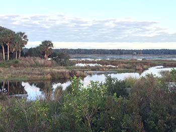
Cape Romain National Wildlife Refuge, SC
As part of the Coastal Carolinas DEWS, NIDIS is currently providing funding to the US Geological Survey (USGS) South Atlantic Water Science Center and CISA to advance the development and use of the Coastal Salinity Index (CSI).
The Coastal Salinity Index
The Coastal Salinity Index (CSI) was developed as a way to characterize coastal drought. Commonly-used drought indices characterize hydrological, agricultural, and meteorological conditions; however they do not incorporate salinity, which is a key stressor associated with coastal drought. Paul Conrads, USGS, developed the CSI using an approach similar to the Standardized Precipitation Index (SPI), substituting total monthly precipitation with average monthly salinity data. The CSI provides a tool to monitor changing salinities in coastal surface-water bodies and associated effects on estuarine habitats, and freshwater availability for ecological, municipal, and industrial needs.
USGS created a CSI R-package for consistent computation of the CSI by different users, developed a website with access to real-time CSIs, and computed the CSI at additional locations across the Southeast U.S. CSIs have been calculated for 97 sites in the South Atlantic and Gulf of Mexico. Real-time CSI calculations are available for 29 of these sites in North Carolina, South Carolina, Georgia, and South Florida.
CSI Information and Resources:
- Coastal Salinity Index website
- CSI 2-Page Information Sheet
- CSI Data Release
- CSI Users Guide
- Coastal Salinity Index Along the Southeastern Atlantic Coast and the Gulf of Mexico, 1983 to 2018 (Matthew Petkewich, Kirsten Lackstrom, Bryan McCloskey, Lauren Rouen, and Paul Conrads, 2019. USGS Open-File Report 2019-1090, DOI: 10.3133/ofr20191090.)
- Development of a Coastal Drought Index Using Salinity Data (Paul Conrads and Lisa Darby, 2017, Bulletin of the American Meteorological Society, DOI: 10.1175/BAMS-D15-00171.1)
- Real-time Salinity Drought Index 2014 Workshop
Indicators and Indices of Drought in Southeastern Coastal Ecosystems
With funding from the NOAA Climate Program Office (2013-2017), CISA conducted this project to improve understanding of coastal resources that are adapted to or dependent upon particular spatial and temporal patterns of salinity. Understanding the relationship between these resources and salinity will inform researchers and managers about the ways in which drought stresses coastal systems.
Phase 1. A needs assessment was completed through structured interviews with 30 resource managers along the Carolinas' coast. These interviews identified opportunities for drought early warning as well as additional data and research needed to effectively understand and monitor drought in coastal ecosystems.
- Needs Assessment of Coastal Land Managers for Drought Onset Indicators in the Southeastern United States (Casey Nolan, Daniel Tufford, and David Chalcraft, 2016, Journal of Coastal Research, DOI: 10.2112/JCOASTRES-D-15-00182)
Phase 2. The second component of this project involved collaboration with the US Geological Survey South Atlantic Water Science Center (USGS SAWSC) to inform the development of the Coastal Salinity Index (CSI). Activities include 1) synthesizing existing information about drought and salinity effects on coastal resources and 2) identifying and documenting salinity and ecological response datasets for calculating the CSI and assessing linkages between ecological variables and salinity levels as expressed by the CSI.
Salinity and ecological response records identified through the research review have been compiled into the following resources:
- Inventory of salinity datasets (spreadsheet resource)
- Inventory of ecological response datasets (spreadsheet resource)
Additional Resources
- Final Project Report: Indicators and Indices of Drought in Southeastern Coastal Ecosystems
- The Impact of Drought on Coastal Ecosystems in the Carolinas: State of Knowledge Report (Steve Gilbert, Kirsten Lackstrom, and Daniel Tufford, 2012)
Testing and Applying the CSI
CISA’s 2018-2019 activities supported engagement with users to assess how the CSI can be applied and provide value to drought monitoring and decision making. A CSI Working Group has provided feedback on the development of the CSI and recommendations for its use by researchers and resource managers. For example, researchers have begun to investigate the linkages between ecological indicators (such as fisheries water quality monitoring data) and varying salinity conditions as expressed by the CSI. Contact Kirsten Lackstrom if you are interested in learning more about these efforts